Bowen Basin
The Bowen Basin contains the largest coal reserves in Australia. This major coal producing region contains one of the world’s largest deposits of bituminous coal. The Basin contains much of the known Permian coal resources in Queensland including virtually all of the known mineable prime coking coal. It was named for the Bowen River, itself named after Queensland’s first Governor, Sir George Bowen.
The Bowen Basin covers an area of over 60,000 square kilometres in Central Queensland running from Collinsville to Theodore. There was a combined population of 41,973 people in the area in 2001. The Ornamental Snake is a small reptile native to the Bowen Basin region.

Major coal mines
Byerwen Mine while still under development employed 1,000 workers in August 2011.
Curragh Mine employed 1,600 workers in August 2011.
Dawson Central Mine employed 1,560 workers in August 2011.
Goonyella Riverside Mine employed 2,360 workers in August 2011.
Hail Creek mine employed 1,270 workers in August 2011.
Peak Downs Mine employed 1,760 workers in August 2011.
Saraji Mine employed 1,615 workers in August 2011.
History
Robert Logan Jack was a Queensland Government geologist who originally reported coal deposits in the basin in 1878. The area around Collinsville was first explored for resources in the 1920s.
In 2006, 60% of Australia’s exported coking coal came out of the Bowen Basin. In 2010, nearly all the mines in the basin were affected by record flooding. Many mines were forced to declare force majeure, meaning they could not meet their contractual obligations.
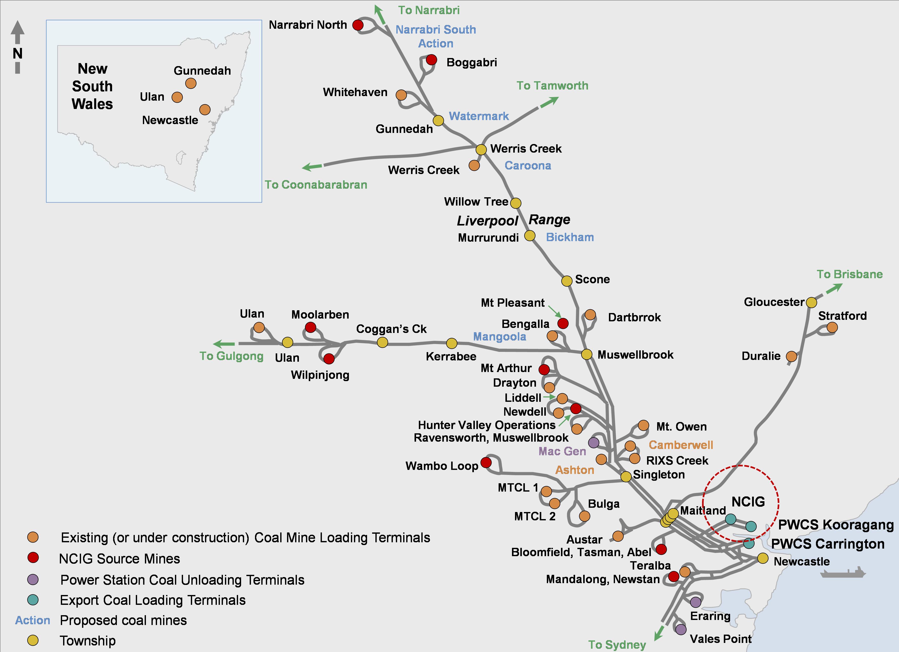
Hunter Valley
The Hunter Valley coalfields contain larely thermal and soft coking coal. Mines near the eastern edge of the basin are spread along the Hunter Valley from Newcastle in the south to Muswellbrook in the north; many of these mines are open-cut. Further north mining also occurs at Yarrawonga near Gunnedah. Mines such as Ulan and Springvale in the Western Coalfield and Mandalong and Westside in the Newcastle Coalfield produce mainly thermal coal. In the Hunter Valley Coalfield both soft coking and thermal coal products are produced from mines such as Hunter Valley Operations and Bulga.